What if you could skip traffic, keep your weekends free, and still reach everything you need within minutes? In Arlington, you can. Whether you’re moving for work, looking to simplify your lifestyle, or testing a one‑car household, this guide shows you how to enjoy Arlington without relying on a car.
You’ll learn where a car‑light lifestyle works best, how Metro, buses, trails, and bikeshare connect your daily routine, and what housing near transit typically looks like. You’ll also get a simple checklist to use when you tour homes. Let’s dive in.
Why Arlington works car‑light
Arlington planned for walkability and transit access, especially along the Rosslyn–Ballston corridor, which clusters homes, offices, retail, and parks around five Metro stations. This approach makes everyday life easier on foot or bike and reduces the need for a car. You can see how the county designed this corridor for transit‑oriented living in the official overview of the Rosslyn–Ballston Corridor.
Multiple Metrorail lines and a robust local bus network connect Arlington to downtown DC, the Pentagon, Tysons, and beyond. Explore current stations and connections on the WMATA station list.
Demand for this lifestyle is real. A recent statewide summary shows Arlington among the Virginia localities with a higher share of households living without a car, a sign that daily needs can be met through transit, walking, and biking. You can scan those findings in the vehicleless households summary.
Your car‑light options by area
Rosslyn to Ballston
This corridor includes Rosslyn, Court House, Clarendon, Virginia Square, and Ballston, all on the Orange/Silver lines. It concentrates dining, shopping, services, and jobs within short walks of the stations. Clarendon and Ballston are known for active retail clusters, and Ballston Quarter is a popular destination for food and entertainment. For a feel of day‑to‑day convenience in Ballston/Clarendon, browse the neighborhood map of stores and restaurants near The Waycroft at this local guide.
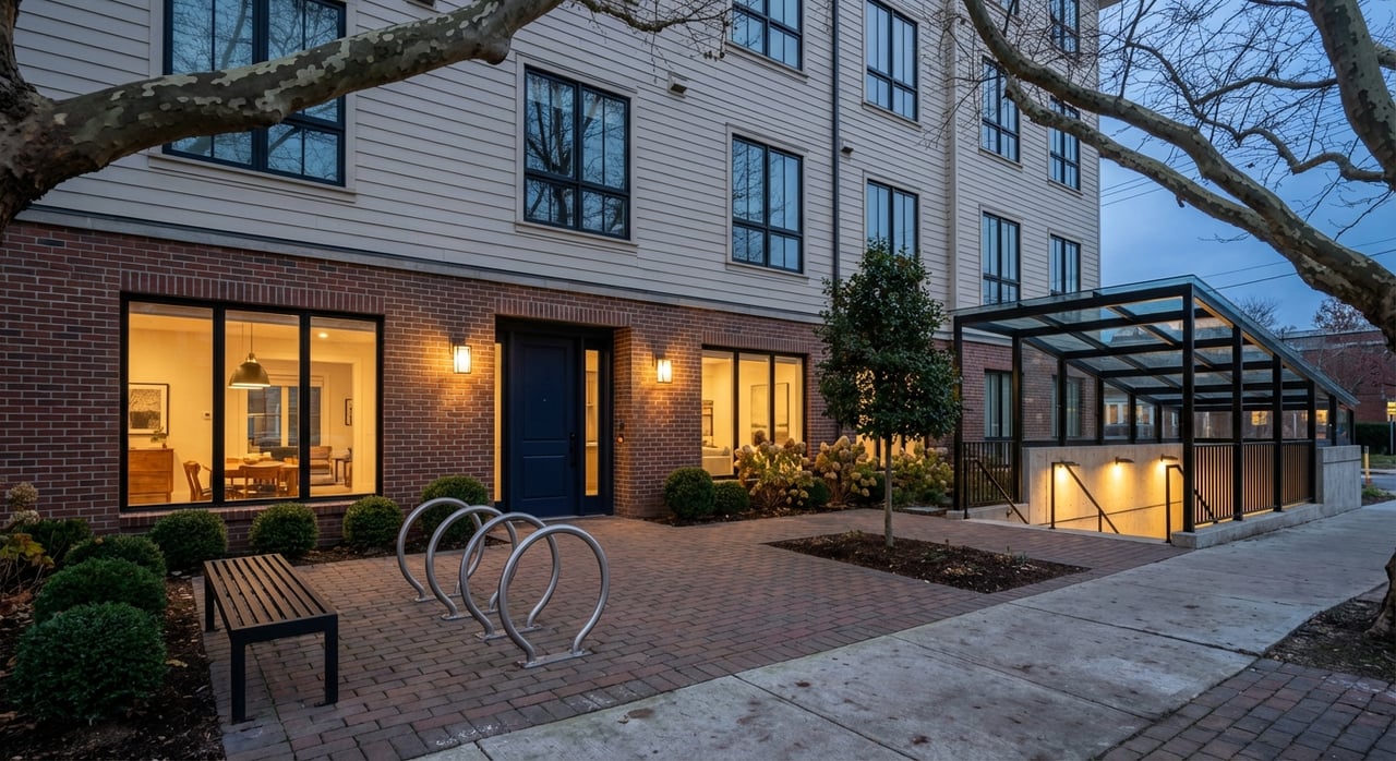
Typical homes near these stations include mid‑ to high‑rise apartments and condos, often above or near ground‑floor retail. You’ll also find nearby blocks of townhomes and small condos a few minutes from the Metro.
National Landing (Crystal City, Pentagon City, Potomac Yard)
National Landing brings together Crystal City, Pentagon City, and Potomac Yard into one connected district with major investment in transit, streets, parks, and public spaces. It sits close to Reagan National Airport and has strong Metro and bus service, which is a plus for frequent travelers. Learn more about the district’s evolution on the National Landing overview.
Expect higher‑density apartments and condos, new mixed‑use buildings, and an increasing number of public plazas and amenities. With two Metro stations and direct airport access, many residents find they do not need a daily car here.
Columbia Pike and Shirlington
Columbia Pike is a long‑standing commercial corridor with frequent bus service and a growing mix of shops, services, and restaurants. Shirlington Village functions like a walkable pocket center with dining, a library, and everyday errands all close together. This area is more bus‑centric than rail‑centric, but it supports a car‑light lifestyle well. Arlington has updated planning and form‑based codes here to support mixed uses and walkability. Review the county’s planning resources for context on how these corridors grow and change in the land use and planning library.
Transit, buses, and bikes at a glance
Metrorail
Arlington’s Metro stations include Rosslyn, Court House, Clarendon, Virginia Square, and Ballston on the Orange/Silver lines, plus Pentagon, Pentagon City, Crystal City, and the airport on the Blue/Yellow lines. Service patterns and hours vary by line and day. For current hours, planned work, and travel times, check WMATA’s official resources starting with the station guide and service FAQs linked from WMATA.
Arlington Transit (ART) and Metrobus
ART buses plug neighborhoods into the Metro spine and make cross‑town trips easier without a car. Routes such as the ART 42 are designed as fast, affordable connections between the Orange/Silver and Blue/Yellow corridors. Explore current routes and frequency on ART’s routes and schedules.
Trails, bikeways, and micromobility
Arlington’s trail network connects homes to stations, parks, and job centers. The Custis Trail, Mount Vernon Trail, W&OD Trail, and Four Mile Run are popular for commuting and weekend rides. Find maps and descriptions on the county’s off‑street trails page.
Capital Bikeshare docks and permitted e‑scooters/e‑bikes make short trips fast and inexpensive. E‑bikes help flatten hills, and dock availability is strong in station areas. For a simple overview of options and riding tips, read the regional roundup in this Arlington biking guide.
Homes near transit: what to expect
Living close to Metro usually means newer or recently updated buildings, smaller private storage, and strong on‑site package rooms. The trade‑off is clear: you reduce driving, save time, and can walk to daily needs.
Immediate station areas. Expect mid‑ to high‑rise apartments and condos, often in mixed‑use buildings with ground‑floor shops. These are the simplest places to live with one car or none because grocery, dining, and transit are a short walk away. County planning materials describe these patterns in the land use resources.
Near‑station neighborhoods. Just outside the core, you’ll find small‑scale condos, townhomes, and walkable residential blocks. Daily life still works car‑light, and you can bike or bus a few minutes to Metro.
Columbia Pike and Shirlington. Housing here mixes garden apartments, newer mid‑rise buildings, and townhomes. Buses, trails, and local retail anchors make it easy to run errands without driving.
Real‑life trade‑offs and tips
Cost and space. Homes closest to Metro often cost more and offer less storage or private parking. Weigh those costs against lower transportation expenses and the time you save by walking and riding.
Parking and deliveries. Some buildings limit or price parking separately. If you keep one car for weekends, ask about monthly garage rates and guest parking. Confirm package rooms and cold‑storage options for grocery delivery.
Night and weekend service. Frequencies drop late at night and during some weekends for maintenance. Before big outings or early flights, check WMATA for planned track work and last‑train times in the service FAQs.
Errands without a car. Most residents mix walking, bikeshare, and short Metro or ART rides. For large shopping trips, use delivery or plan an occasional rental or ride‑hail. Many find they do not need a full‑time car to stay flexible.
Airport access. Ronald Reagan Washington National Airport sits right on the Blue/Yellow lines in Arlington. Many travelers roll a carry‑on to the station instead of arranging a ride.
How to shop for a car‑light home
Use this quick checklist when you tour:
- Confirm nearby Metro lines and walk times. Start with the WMATA station list and map your commute.
- Check bus coverage on your block. Review ART routes and schedules and see how they connect to Metro.
- Look for bikeshare docks and trail links. The off‑street trails map and this biking guide are helpful.
- Verify grocery, pharmacy, and coffee within a 5–10 minute walk. For a snapshot of options around Ballston/Clarendon, check this neighborhood directory.
- Ask about secure bike parking and package rooms. Arlington’s planning guidance encourages bicycle facilities in site plans. See how buildings support cycling in the land use resources.
Find your fit with local guidance
If you value time over traffic, Arlington makes car‑light living practical and enjoyable. The key is to match your daily routine to the right block: station‑area high‑rises for maximum convenience, near‑station townhomes for a balance of space and access, or bus‑rich corridors like Columbia Pike if you prefer a village feel with frequent service.
Ready to explore homes where your life works on foot, bike, and rail? Reach out to Stacie Hennig Davis to compare neighborhoods, tour condos and townhomes near transit, and build a clear plan for a smooth purchase or lease. Schedule your consultation when you are ready.
FAQs
Can you commute to downtown DC without a car from Arlington?
- Yes. Multiple Arlington stations on the Blue, Orange, Silver, and Yellow lines provide direct rail to downtown DC. Check the WMATA station pages for the fastest option from your address.
Is a car‑light lifestyle practical for a household with kids in Arlington?
- Many families choose homes near grocery, parks, and childcare within walking distance or on direct bus routes. Housing type and unit size matter, so map daily trips and confirm ART and Metro access before you buy.
How do you run errands without a car in Arlington?
- Most errands are short walks or quick trips with Capital Bikeshare, e‑scooters, or ART and Metro. For bulk items, schedule delivery or plan an occasional rental or ride‑hail.
What if you only need a car sometimes?
- Keep a one‑car household, rent by the day, or use carshare where available. Many buildings are near hourly or daily garages for flexible parking.
Which Arlington areas are most walkable and transit‑rich?
- Station‑area neighborhoods on the Rosslyn–Ballston corridor and National Landing offer the highest concentration of rail, retail, and services. Columbia Pike and Shirlington work well with frequent buses and strong local amenities.